Toph

Real time earthquake routing and safety navigation powered by live seismic data

Role

UX / Product Systems Designer · Full Stack Engineer

Industry

Civic Tech · Disaster Response

Duration

10 Weeks

Identifying Critical Gaps in Post-Earthquake Navigation

Growing up in İzmir, an active earthquake zone, I experienced how the first minutes after the shaking stops can determine outcomes. To ground this locally, I interviewed Seattle residents and reviewed public evacuation resources. While most participants owned emergency kits, very few knew their nearest Safe Assembly Area. Existing evacuation maps were largely static PDFs without live routing or offline support.

The opportunity became clear:

How might we transform raw seismic data into immediate, actionable safety guidance during the first two minutes after impact?

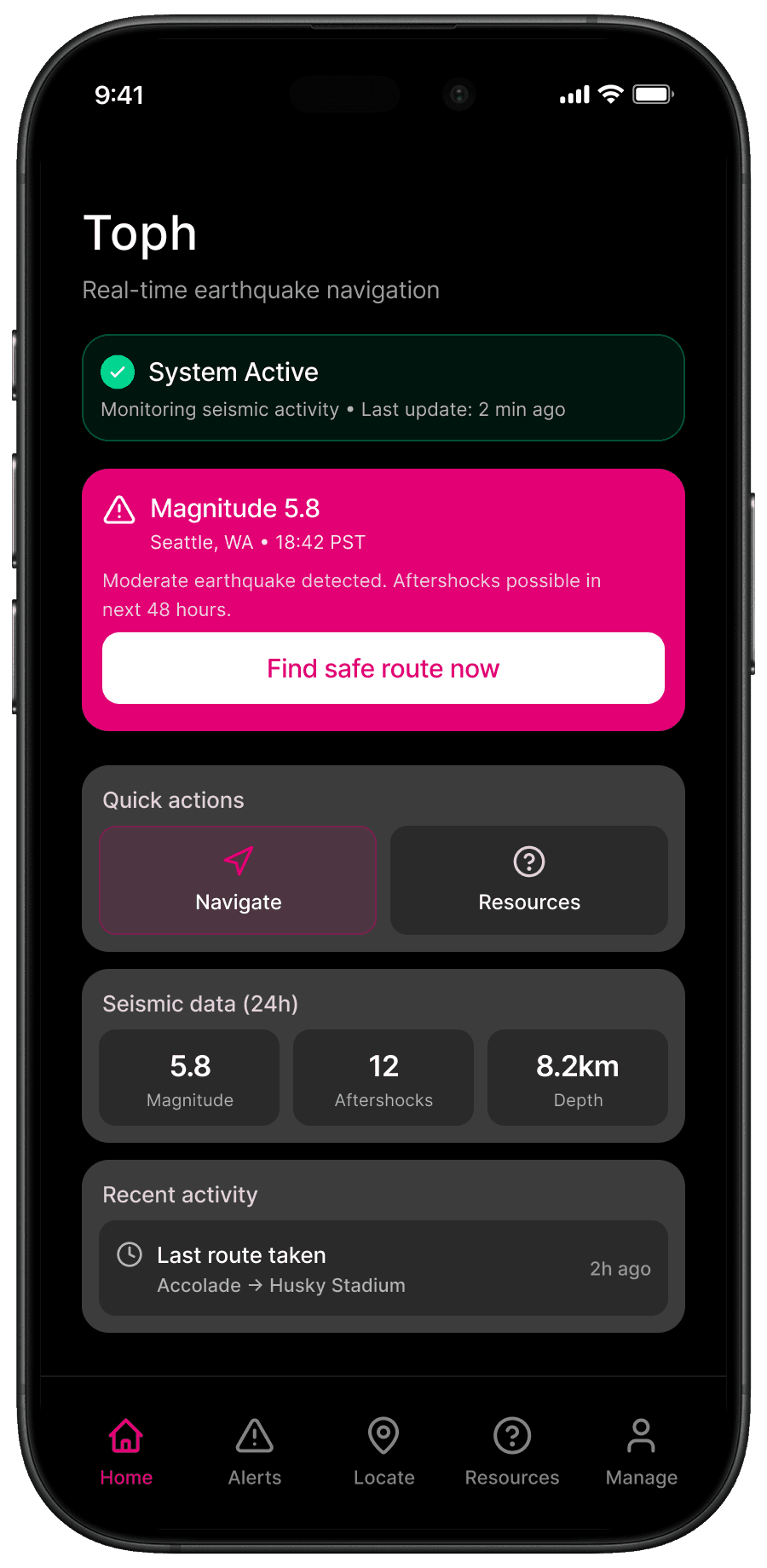
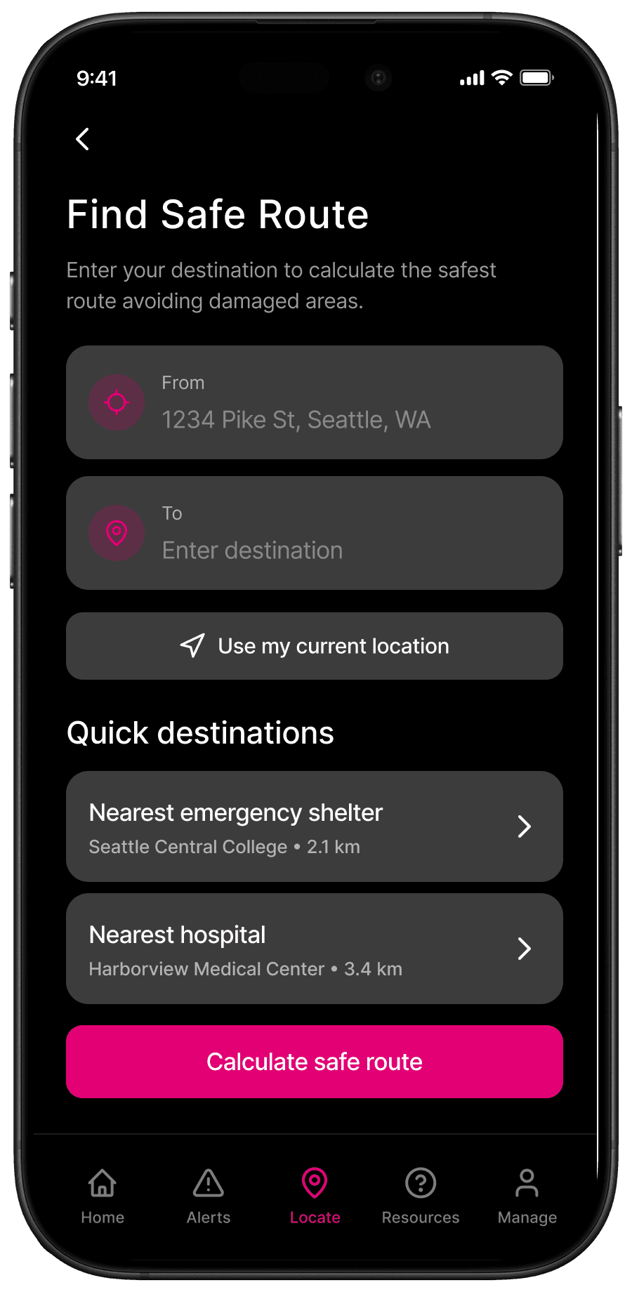
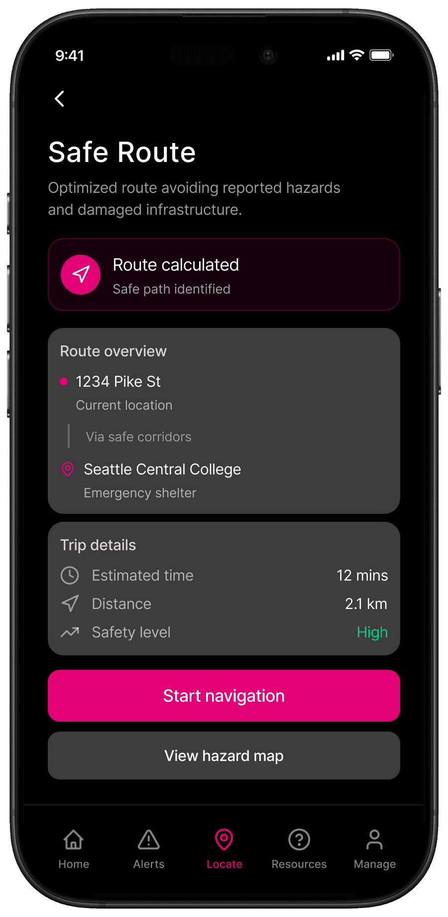
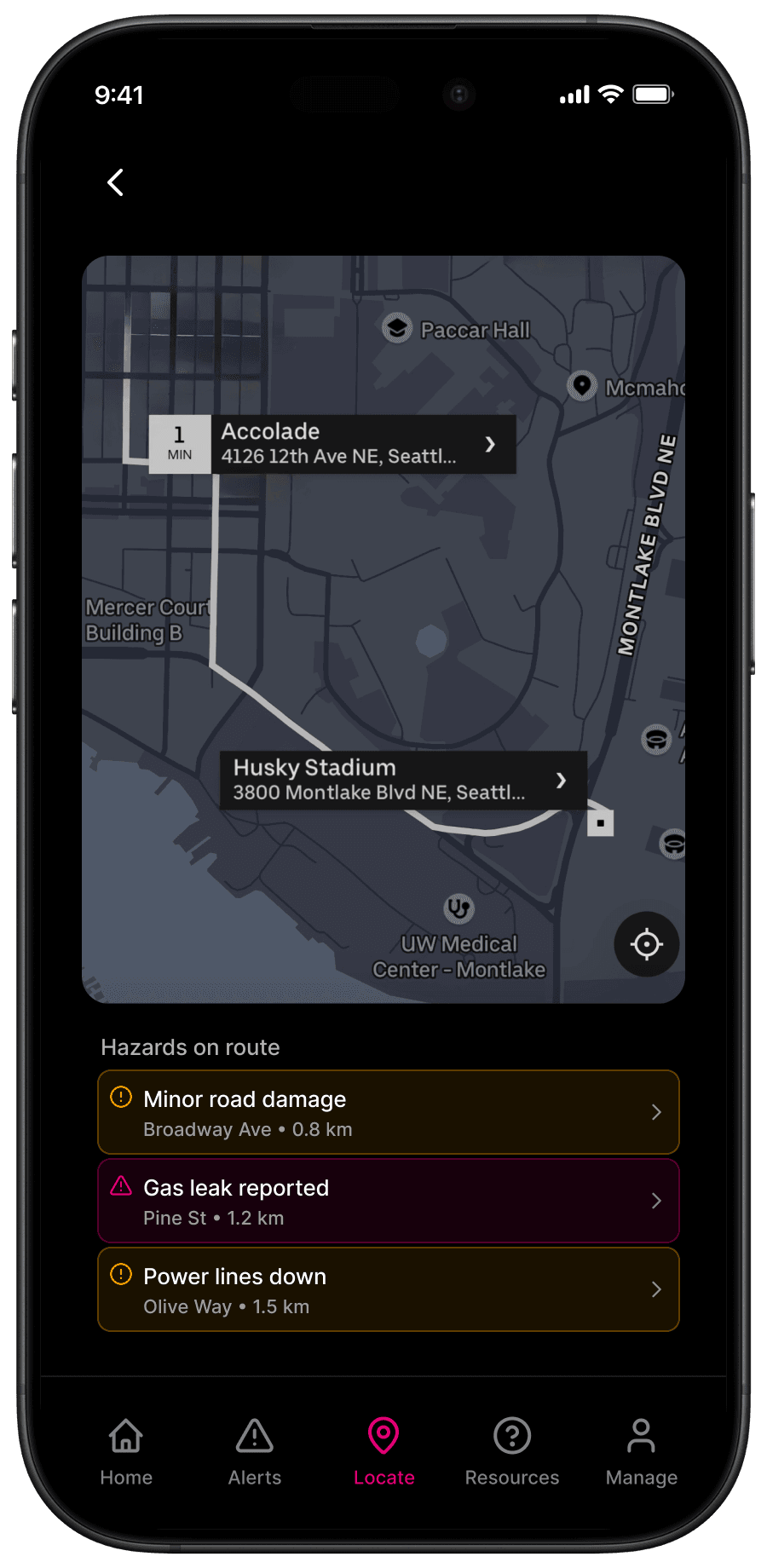
Designing a Two-Minute Safety Navigation Flow

In high-stress moments, complexity becomes dangerous. I reduced the interaction to a clear three-step flow:

• Receive alert
• Locate a safe destination
• Navigate with confidence, even under unstable connectivity

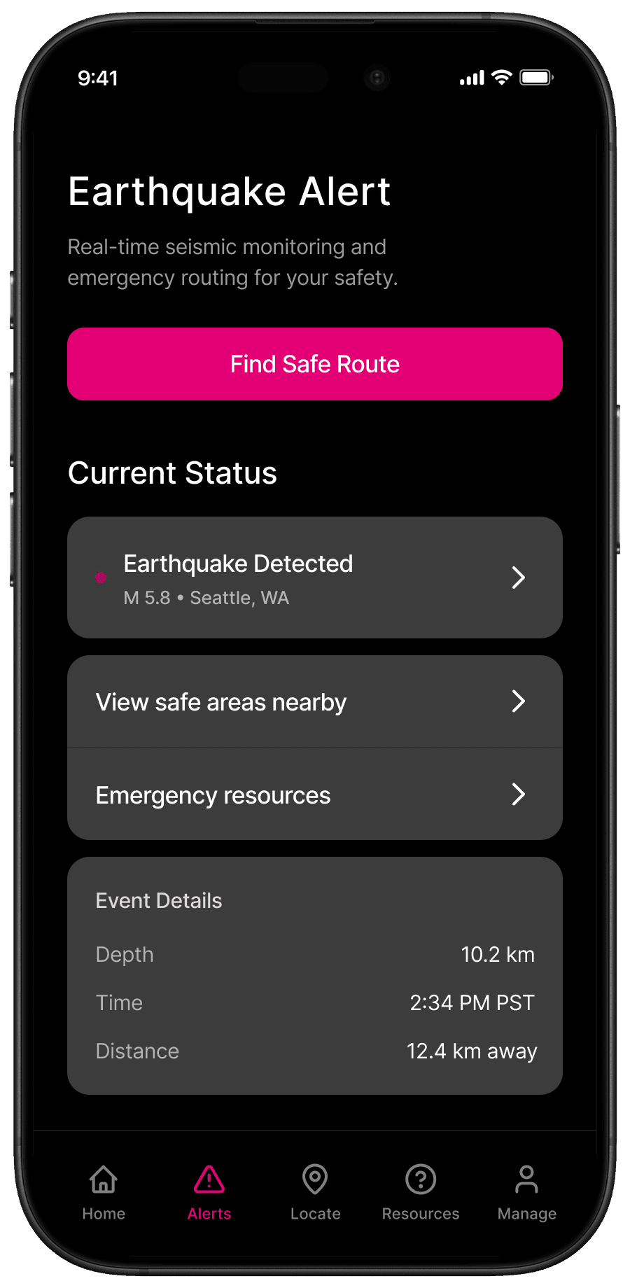
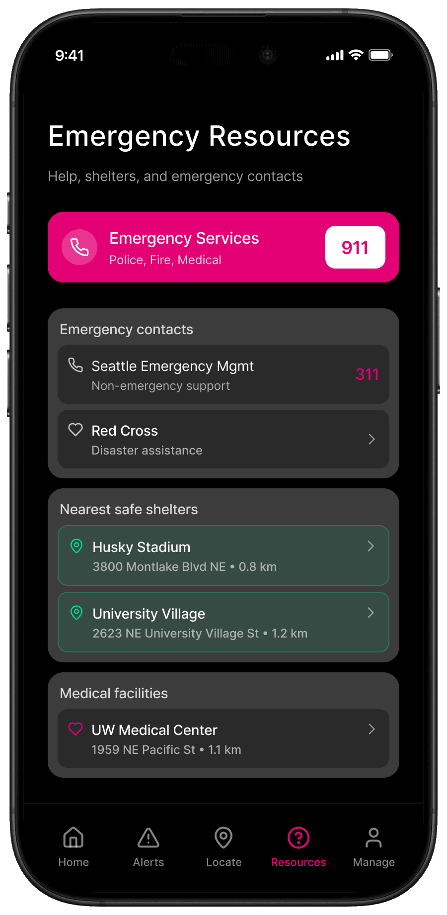
The Alert screen prioritizes clarity and urgency. The Resources view anchors the system in real-world support networks such as shelters, hospitals, and emergency services. Together, these screens serve as the entry point into a broader safety ecosystem.

Rather than overwhelming users with data, the interface emphasizes hierarchy, legibility, and one-handed usability. Every decision was filtered through a single question:

Would this reduce hesitation under stress?

Building a Real-Time Routing System from Live Seismic and Map Data

To move beyond static maps, I developed a Flask-based prototype integrating live seismic feeds with geolocation routing APIs. The system pulls real-time USGS earthquake data, connects to a routing engine, and evaluates path safety dynamically.

Instead of assuming a route is safe, the system calculates it in context. Each request fetches the latest event data, computes possible routes, and evaluates proximity to the epicenter before returning a safety status.

The Find Safe Route and Route Summary screens translate backend logic into a clear decision moment. Distance, estimated travel time, and a distinct safety indicator provide reassurance without interpretation.

This layer bridges backend computation and human perception.
The goal was not just technical correctness, but cognitive clarity.

Designing Under Real-World Constraints

An emergency routing system operates under hard constraints where seconds and bandwidth directly affect safety.

Key tradeoffs shaped the architecture:

Latency vs Accuracy
Fast first results were prioritized, with progressive safety refinement layered after initial response.

Network Reliability
The system anticipates post-quake congestion and explores local caching strategies to prevent total failure.

External Dependency Risk
Third-party APIs introduce rate limits and outage risk. The architecture isolates these dependencies and enables graceful degradation.

Safety Implications of Information Design
Only actionable hazards are surfaced along the route. Raw data is filtered to prevent overload.

The objective was not feature completeness.
It was operational reliability under pressure.

Validating Route Safety Logic and Interface Clarity Under Time Pressure

I tested the prototype with 7 participants under simulated stress scenarios to evaluate both routing logic and usability. Participants entered origin and destination points while the system recalculated routes in real time.

Hazards were integrated directly into the route layer rather than separated from the map. This unified presentation reinforced situational awareness without visual clutter.

Users interpreted the Safety Check status within seconds and acted confidently.

Top Findings

• Users quickly understood the Safety status and relied on visual contrast to guide decisions.
• Overlaying hazards on the route improved situational awareness compared to separating warnings from navigation.
• The simplified three-step flow reduced hesitation under time pressure.

Changes Implemented

• Increased contrast on safety indicators
• Simplified route summary hierarchy
• Removed competing secondary visual elements

Measured Outcome

• Average time from alert to confirmed safe route: under 8 seconds.
• Participants reported higher confidence in acting on recommendations compared to static evacuation resources.

Preparing Scalable Emergency Routing with Public Data Integrations

While the current prototype demonstrates real-time routing and safety scoring, the next phase focuses on resilience and deployment readiness by integrating the mobile UI with the existing system.

Major earthquakes often disrupt cellular infrastructure. To mitigate this, future iterations would explore:

• Pre-caching regional map tiles and shelter data for offline fallback
• Edge caching recent seismic feeds to reduce latency
• Lightweight safety scoring that runs on-device when connectivity drops

This hybrid model allows the system to degrade gracefully rather than fail.

The long-term goal is to evolve Toph from a functional prototype into a deployable, mobile-first emergency system.

A working version of the existing system can be accessed here:

Toph_Website


Other projects